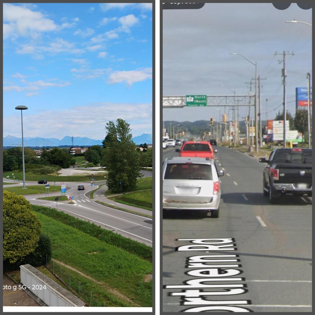
More often than not, when driving eastbound on Second Line (2nd Line), and turning left onto Great Northern Road (GNR), you may become trapped in the intersection because vehicles are lined up all the way to the Walmart and GNR intersection. In short, vehicles are backed up from the Walmart intersection to the GNR and 2nd Line intersection, leaving drivers stranded as the traffic lights cycle through. On many occasions, I have witnessed a line of vehicles also backed up from the GNR and 2nd Line intersection, past the Walmart intersection, and going as far back as the Home Depot intersection. There are many intersections in very short order from the Home Depot intersection to the 2nd Line intersection on Great Northern Road that can no longer handle the volume of traffic.
This past summer, I spent some time in Europe, and I learned how a road should be planned and built so that a “road” functions properly. A properly planned road will include an intersection, usually a traffic circle, that collects all the streets within that area. It then heads off to another part of the city, where it has another circular intersection that allows streets to radiate outward from the circle to a business or residential destination. One branch of the circle will again repeat the road to another area of the city or a major highway. The road itself has no houses, businesses, or driveways that intersect it. The road’s sole purpose is to take you from one area of the city to another without any interruption.
After exiting the circle intersection, that “street” becomes the business or residential destination. Therefore, streets are the destination.
A highway’s function is to take you from one city to another without interruption. Ontario’s 400 series highways, or the United States Interstate Highway system, are examples of how properly designed, planned, and built highways function. Their function is very defined: move vehicles quickly and safely, with no intersections or interruptions.
The urban advocacy group “Strong Towns” or “City Nerd” decries the bad city planning of Stroads. A Stroad is a portmanteau of combining the functions of a street and a road, creating a hazardous place for pedestrians, bicyclists, and vehicular drivers alike.
Great Northern Road, Second Line, numerous traffic light intersections, and many driveways have rendered the entire area a dangerous Stroad, compounded by the fact that it also serves as our National Highway.
From 1969 onward, the Ontario Government designated Trunk Road, Black Road, Second Line, and northbound Great Northern Road as Sault Ste. Marie’s National Highway bypass. In the Rebuilding a City: The Urban Renewal of Greater Sault Ste. Marie, 1961, by Mr. E.G. Faludi, Planning Consultant, cautioned our City Planners and Leaders to keep the Sault compact and understand that 2nd Line and GNR would serve our City as the National Highway bypass.
What happened. Why did we move everything to Great Northern Road? According to the 1961 Rebuilding a City Report, the Sault would see significant population growth, but it cautioned that the Sault Urban Settlement Area should remain compact. Control urban sprawl, keep growth under the National Highway bypass.
Nobody heeded Mr. E.G. Faludi’s recommendations, and there is a straightforward reason: “We need to expand our municipal tax base.” The mantra of every Mayor and Councillor since 1990. Every Mayor and Councillor demanded the same thing: more municipal tax base. This mantra would be acceptable in most Southern Ontario cities with a constant influx of people; however, Mr. E.G. Faludi’s prediction of the Sault’s population fell far short of his projection of 103,000 for the Sault’s Urban Settlement Area by 1980.
By the mid-1980s, the Sault population had stalled. Yet, the City Council, with the Planning Department’s approval, green-lighted the construction or relocation of big-box retail, offices, commercial and retail space, hospitals, medical testing facilities, banks, and many other businesses to Great Northern Road. All of these businesses were just thrown onto Great Northern Road, our National Highway bypass, because it was the cheapest way to do it; there was no plan to create a proper Big Box outlet centre away from the National Highway. The City wanted the additional tax base but didn’t want to spend the money needed to plan, design, and build a business spur for a proper big-box outlet centre away from the Great Northern Road, also our National Highway bypass.
Our City continues to experience more commercial developments in the Great Northern Road and Second Line area; again, these developments will provide much-needed additional municipal tax base; however, they will also increase traffic in an already congested area.
Our City Council, Planners, and Administration must realize that Great Northern Road is our new Downtown. It is a destination: a “street”. It can no longer function as a thoroughfare: a “road”.
Great Northern Road and the City at large can no longer function as our National Highway bypass, also. Our City needs a new National Highway bypass, just like our neighbouring cities possess. Sudbury is a perfect example of how a properly built National Highway bypass system enables a City to function better, grow, prosper, and provide the traffic safety a modern City requires. Now is the time for our Provincial and Federal Government to build a proper Highway bypass around Sault Ste. Marie as a Nation Building Project.
Mark Menean, http://www.saultblog.com
Thank you: Rebuilding a City: The Urban Renewal of Sault Ste. Marie, 1960-1980

Leave a comment